Why a Village Sits Where It Does
Why a village sits where it does often comes down to water, workable ground and routes. Read the landscape to understand its location more clearly.
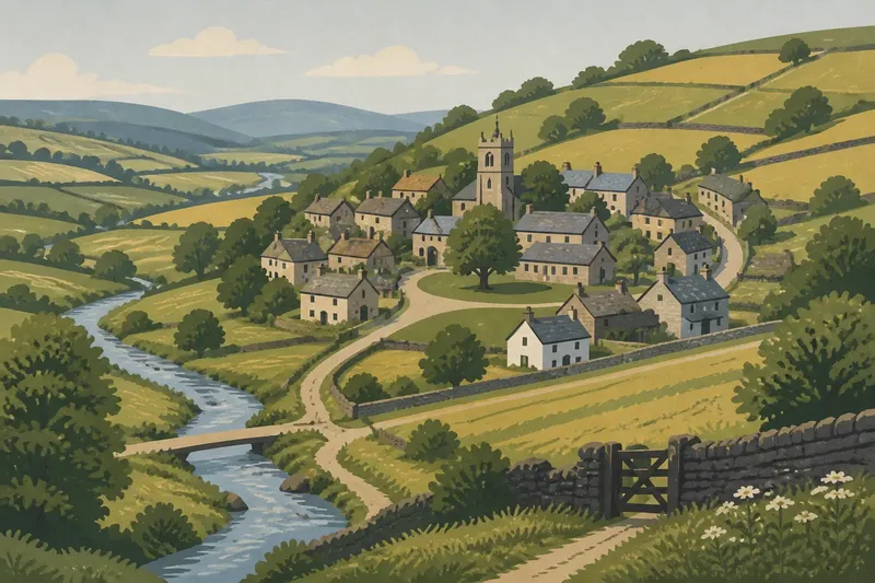
Why a village sits where it does is easier to understand when you look beyond its centre to the ground around it. A stream, a sheltered slope, a crossing or a patch of workable soil may explain more than the village’s present-day road signs. These clues are useful, but they do not amount to a single recipe: settlements grew under different conditions, and many changed as transport, land use and public services changed.
Start with a simple question: what problem might this particular site have helped people solve? A settlement needed access to essentials, but also ground on which homes and activities could be placed. Water, landform, routes and nearby resources interacted. The village’s position is often the result of several modest advantages, rather than one dramatic feature.
What does the landscape offer here?
Water is an obvious place to look. A stream, spring or river could supply water and support livestock, gardens or local work. Yet proximity has limits. Low ground beside a river may be exposed to flooding, while steep banks make access awkward. A village might therefore stand above the water, close enough to reach but not directly beside it.
Look for a slight rise, a terrace or a change in slope between buildings and a stream. Such a position can offer firmer ground and a route down to water. The detail matters: a narrow valley with a dependable spring presents different choices from a broad river plain. A blue line on a map identifies water, not whether the bank is accessible or the adjacent ground suitable for building.
Landform also shapes movement and visibility. A sheltered hollow can reduce exposure to wind; a ridge may keep a route on drier or firmer ground. A steep hillside can offer shelter on one side and make building or travel harder on another. Treat each feature as a trade-off, rather than assuming that a picturesque setting was necessarily the most practical one.
Imagine a village shown on a slope above a small stream. If you follow the contours, you might notice that the oldest-looking cluster occupies a gentler shelf, with a path descending towards a crossing. That combination would make a reasonable explanation for the location: usable ground near water and a route across it. It would remain an interpretation, not proof of why the first homes were built there.
Why might a village stand near a route?
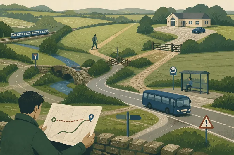
Paths and roads connect settlements to fields, neighbouring villages, markets, places of worship and other destinations. A route that follows a valley floor may avoid difficult slopes; a crossing can bring paths together. A village near such a junction might have offered travellers and local people a convenient place to meet, trade or obtain services. The present road network, however, may not preserve the earlier pattern.
Check how roads meet the settlement. Does a main road pass through, skirt the built-up area or end there? Do smaller lanes point towards a river crossing, a ridge or nearby hamlets? On a map, compare the road line with contours and watercourses. In person, look for changes in width, surface or direction, but do not assume that an older-looking lane has always served the same purpose.
Routes also shift. A bridge, new road, railway or change in traffic can draw movement away from a village or towards it. The resulting village may have two patterns at once: an older core clustered around a lane or green, and later development following a newer road. What looks like a confused layout can be a record of changing connections.
How do nearby resources shape the pattern?
Resources include more than water. Fertile soil, pasture, woodland, stone, clay or access to a suitable landing place could influence where people lived and worked. The relevant resource might not sit under the village itself. Homes could be placed on better-drained ground while fields, grazing or woodland lay nearby, reached by paths and tracks.
Different land uses leave different clues. Open fields may surround a compact cluster; scattered farms may sit among larger holdings; buildings may line a road where land was divided into narrow plots. None of these forms, by itself, identifies the resource or the history behind it. Look instead at the relationship between buildings, field boundaries, terrain and routes.
Nearby work can matter too. A mill needs a suitable watercourse; a quarry depends on stone worth extracting; a market needs people able to reach it. These activities may have influenced a village’s growth or exact position, but their traces can fade or be reused. A former mill building, for instance, is a clue to ask about, not an explanation of every part of the settlement.
Think of the landscape as a kitchen table: the objects on it make more sense through their arrangement than through any one item. A stream, lane and patch of level ground each say something; together they can suggest why a village took shape there. The analogy has limits, since land and human choices are less tidy than objects left in place.
What can the village layout tell you?
Notice where buildings cluster and where they thin out. A compact centre may sit near a church, green, crossroads or former workplace, while later homes extend along a road. In other places, buildings are dispersed among farms and lanes, with no obvious central square. A village’s layout reflects both the conditions of its original site and later decisions about building and land.
Useful things to compare include:
- Contours: Do buildings favour flatter ground, a shelf or a sheltered side of a slope?
- Water: Is a stream, spring or river close by, and is there a plausible route to it?
- Crossings: Do roads or paths converge near a bridge, ford or narrow valley?
- Field patterns: Are boundaries regular, irregular, or shaped around slopes and water?
- Building clusters: Is there a compact core, roadside growth, or a scattered pattern?
- Edges: Does the settlement stop at steep ground, flood-prone land, woodland or a change in soil?
Use a topographic map first, then compare it with an aerial view and what you can see on the ground. Maps simplify features and may use different levels of detail. If a supposed path or watercourse is unclear, treat that uncertainty as part of the picture rather than forcing it into a neat explanation.
What questions help explain a village’s location?
Did villages always grow around a church or green?
No. A church or green can mark a centre, but it may have been added after settlement began or may have served a wider area. Compare its position with older-looking lanes, water and the terrain before treating it as the original focus.
Why are some villages on hillsides rather than beside rivers?
Higher ground may be firmer, less exposed to flooding or better placed beside a route. Residents could still reach water below, though the convenience of that arrangement would depend on the slope and the available paths.
Can a village’s shape reveal what people did there?
It can suggest possibilities, such as farming, roadside trade or work tied to a local resource. Shape alone cannot settle the question, because later building and changes in land use may have altered the original pattern.
Why might the main road miss the village centre?
A newer route may have been built to carry traffic around the older settlement, or earlier travel may have followed a different path. The road’s relation to the village core can therefore point to change rather than a poor choice of location.
How should you weigh competing explanations?
Several clues may point in different directions. A village could be near water but set back from the bank; close to a route but screened from it; or built on useful ground beside a resource that later lost its importance. Prefer an explanation that accounts for several visible features without claiming more than they can support.
Separate what you can observe from what you infer. “The older-looking cluster sits above a stream and near a road crossing” is an observation. “It was founded there to control the crossing” is a stronger historical claim and needs evidence beyond the layout. Local records, place-name sources or knowledgeable local historians may help resolve questions that the landscape leaves open.
For a particular village, begin with the main search phrase—why a village sits where it does—and make it specific: which ground, water and routes meet at this place? That small shift prevents a general pattern from being mistaken for a local fact. The landscape can explain what was possible; the village’s surviving records and layers of development help explain what actually happened.
One useful last check is to look at the settlement from its edge, not only from its centre. A change from level fields to a steep slope, a lane narrowing towards a crossing, or buildings stopping at a wet patch can make the location’s practical logic clearer. The boundary often reveals the constraint that the village centre conceals.